Parched Earth
Déshérence
2022 – 2023
Parched Earth
Déshérence
Déshérence
2022 – 2023
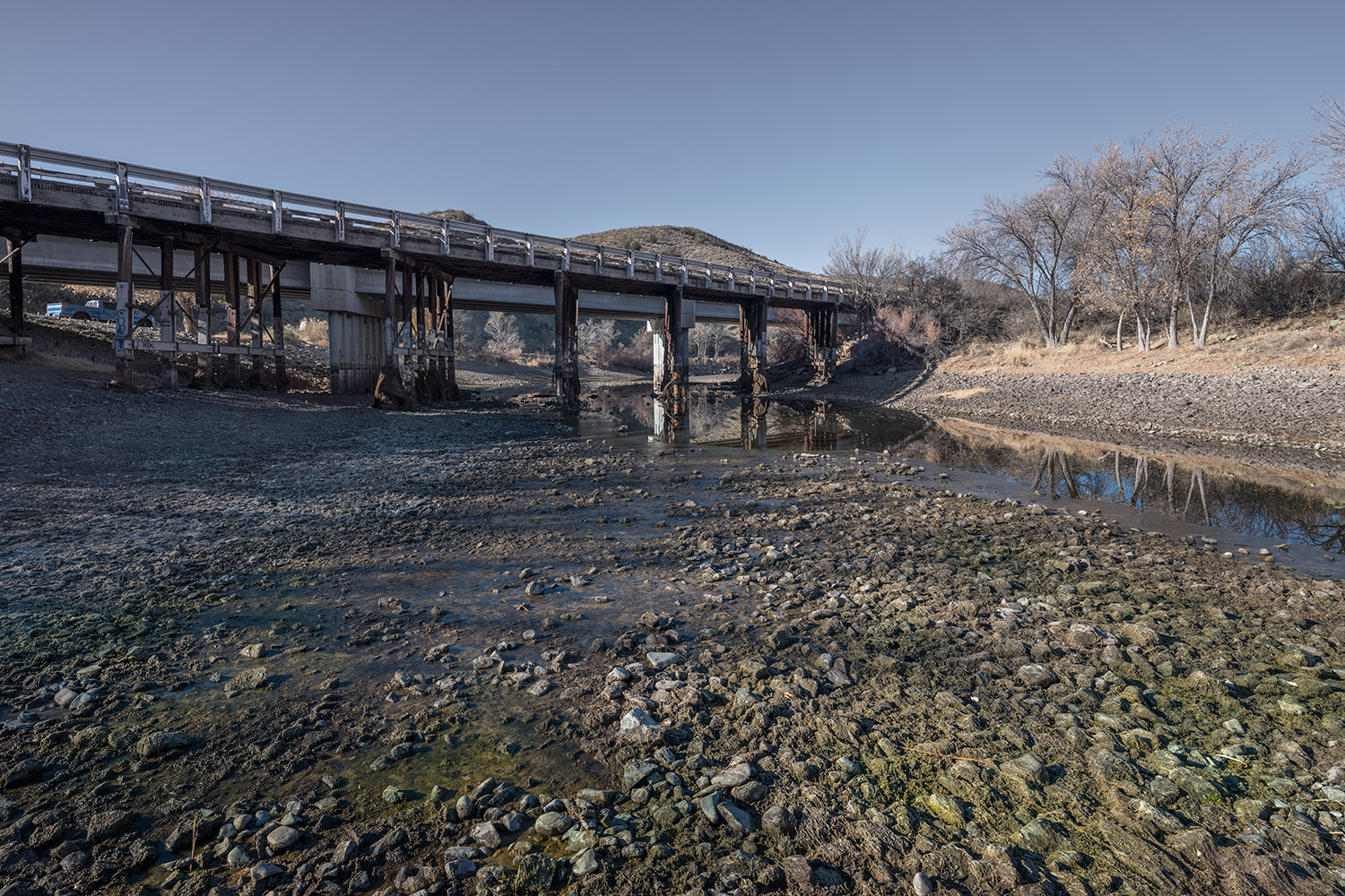
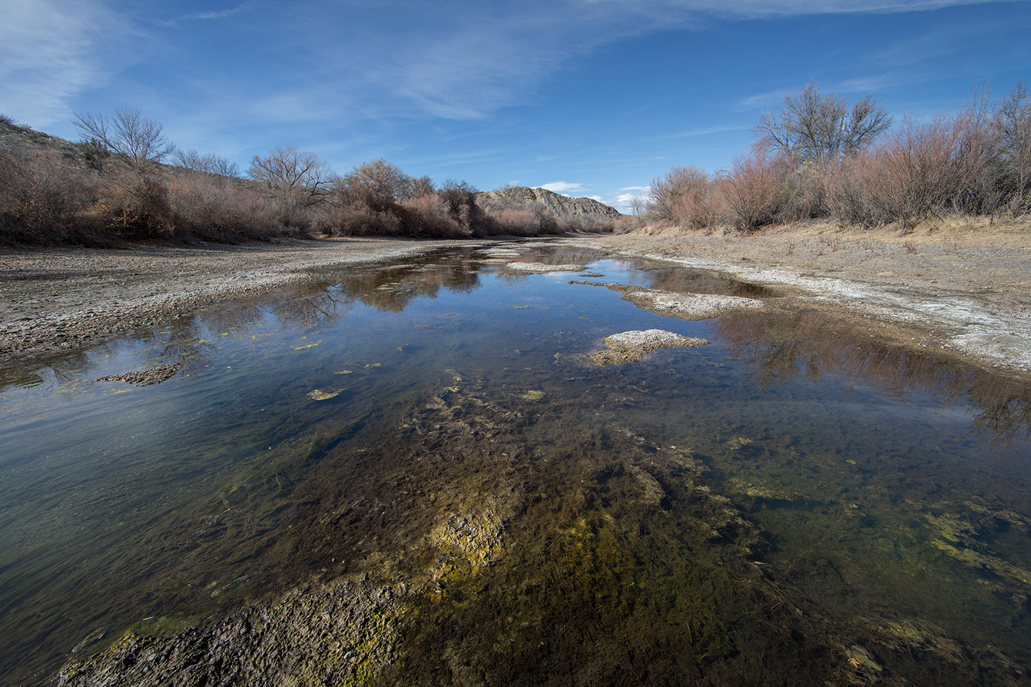
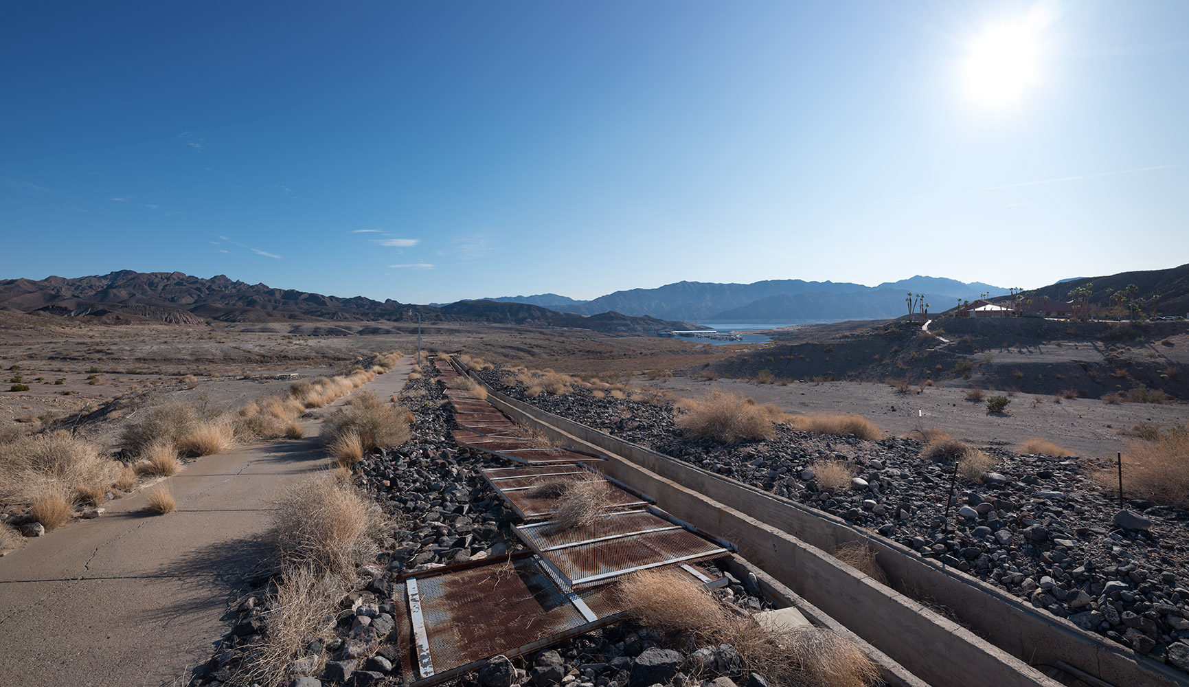
The Western United States has been dealing with a major drought for close to twenty years. As a result, watercourses are drying up and reserves are lower than ever. In a mere fifteen years, flow rates in Colorado have diminished by about 20%, due, it is said, to the combined effects of evaporation, reduced intake and the increased use of water resources. For a long time now, this natural resource has been overused in order to supply big cities like Los Angeles, Phoenix and Las Vegas, which were built in the middle of the desert and continue to expand into it. Although the region’s agriculture has continued to prosper, nobody knows how long this will continue. Responding to the growing demand for water is becoming increasingly difficult in our time because the vast hydraulic infrastructure designed to conserve it was built at a time when floods, not drought, were the main source of concern.
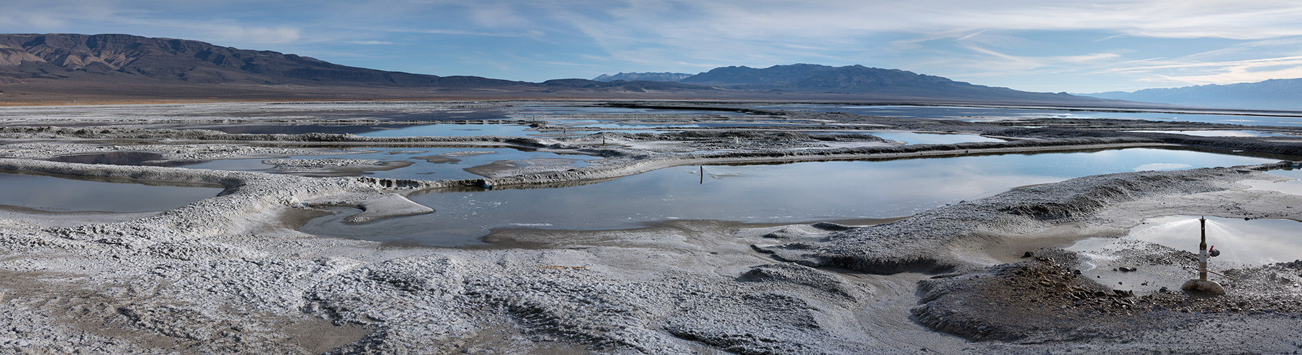
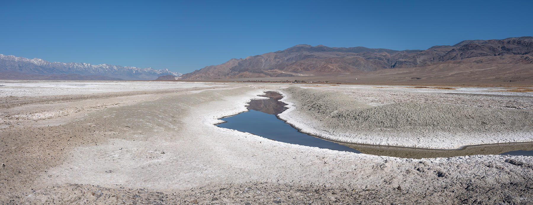
The salt flat of Owens Lake lies east of the Sierra Nevada mountain range in California. Since this chalky plain is blinding in the sunshine, I had to photograph it at dawn to fully appreciate the complex mineral structures that dot its surface. Over the course of that same day, bulldozers arrived to spread layers of gravel over the desiccated sodium to contain the toxic sediments that would otherwise be carried on the wind. The gashes left by these machines across this livid expanse made it look even more desolate; like scars, they reminded me of the wounds caused by the California “water wars.” In the previous century, these conflicts pitted the farmers of Owens Valley against the builders of the Los Angeles aqueduct system. Before these quarrels over water rights and the diversion of the Owens River, the lake covered an area of 280 square kilometres and had an average depth of twelves meters. Only a few shallow basins remain but ponds are being created for migratory birds in an attempt to restore the surrounding ecosystems.
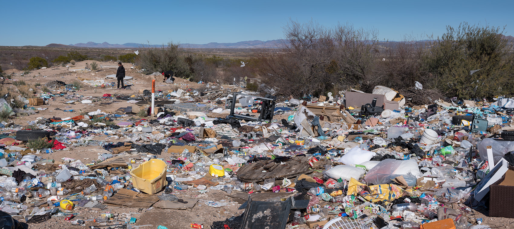
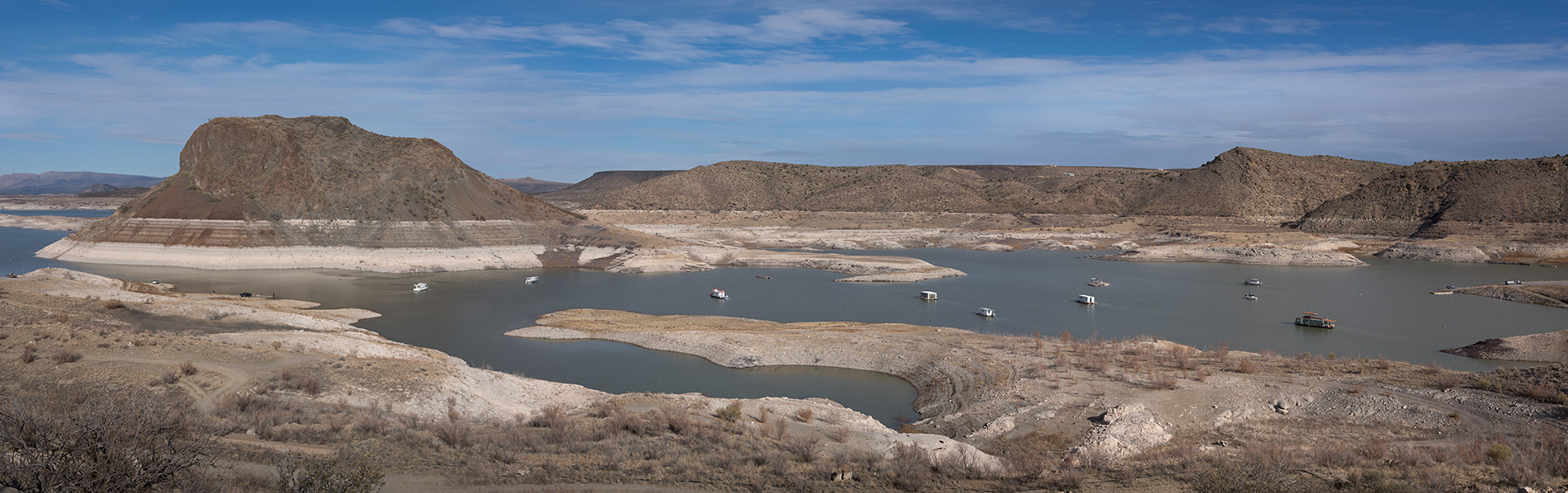
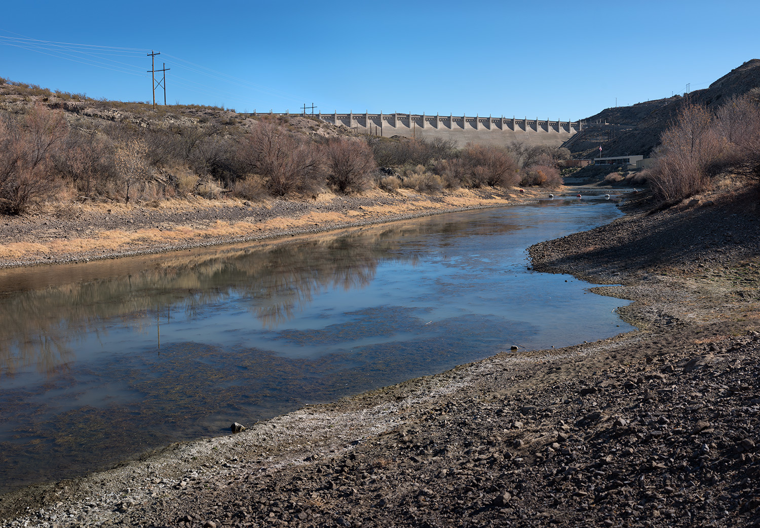
The San Carlos Dam is located on the land of the San Carlos Apache community in Arizona. This Amerindian reservation, one of the poorest in the United States, was once known as “Hell’s forty acres” because of the terrible environmental and sanitary conditions that prevailed there until the late nineteenth century. The Coolidge Dam, built on the Gila River in 1930, was intended to irrigate the neighbouring agricultural land. However, this artificial lake has been filled to capacity only three times since its construction and has often remained almost completely empty. On the horizon, bare hills surrounded by vast stretches of sand indicate that the water level in the dam has indeed fluctuated over time. The infrastructure near the launch ramp appears to be in poor condition and the site is littered with trash, forming a striking contrast with the serene beauty of this semi-arid landscape.
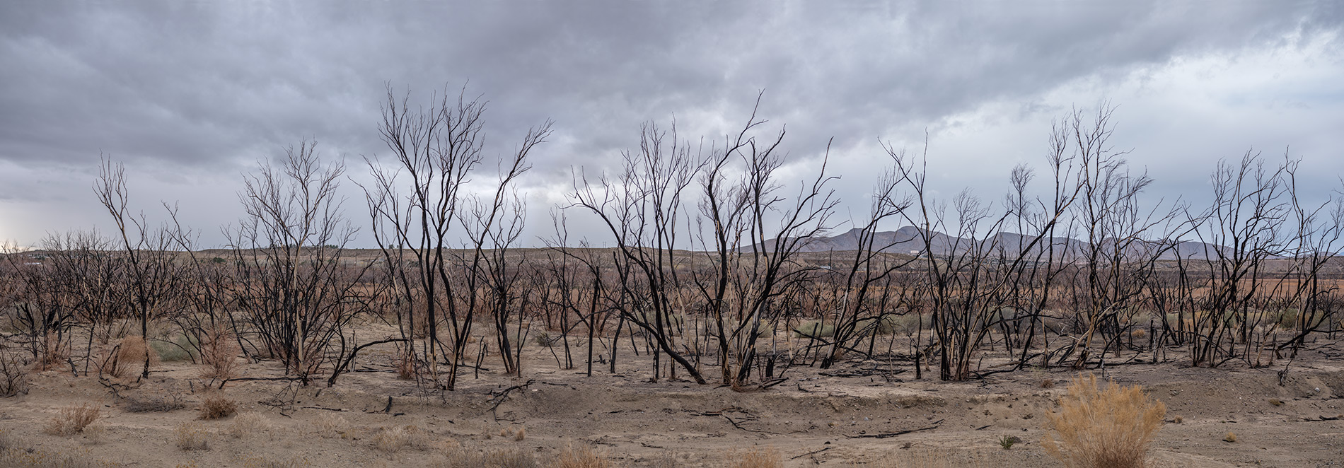
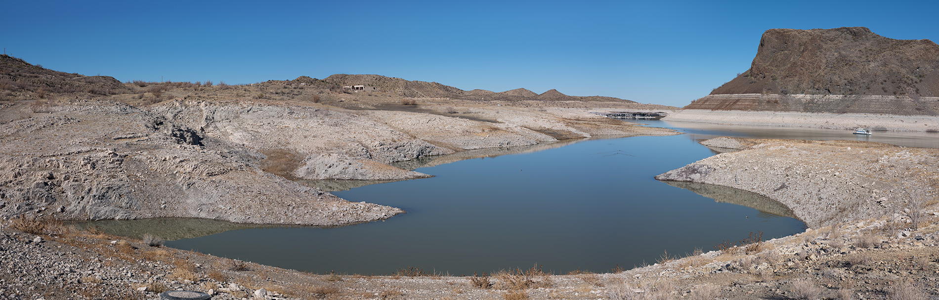
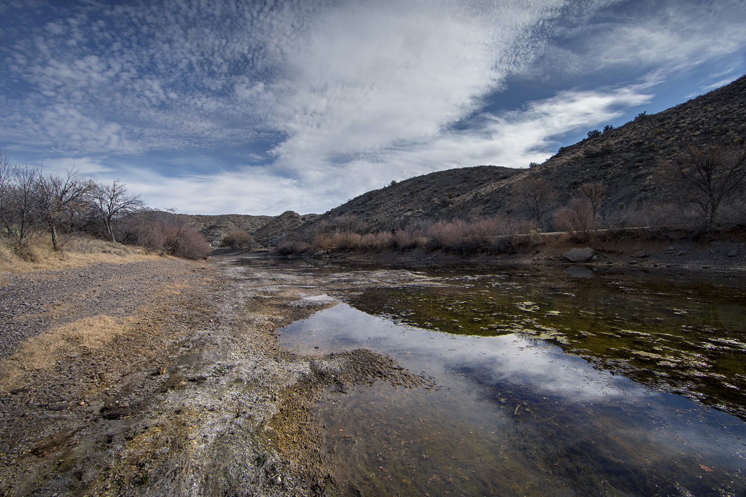
The Rio Grande draws its water from the Colorado Mountains and stretches over 3060 kilometres to the Gulf of Mexico. The river here is barely more than an algae-covered stream, the stink of which causes a sudden wave of nausea. Close to where I am staying, I meet a couple of retirees, Dave and Larry, who live in their vans and camp in the hills. Larry tells me that the dam gates are closed during the dry season to prevent further drops in the water level, which is currently at only 13% of its initial capacity. I spend over three weeks observing and photographing these desolate places. At one point, I notice a dilapidated sign that once welcomed boaters to the Damsite Historic District; it reads: Making tomorrow’s memories today. I think about this as I contemplate these lands, which were once under water. Today, the desert is reclaiming these landscapes laid out by civilization, where cacti are once again growing.
FRANÇAIS
Une sécheresse importante affecte l’Ouest américain depuis une vingtaine d’années, par conséquent les cours d’eau se tarissent et les réserves connaissent leur plus bas niveau. En quinze ans seulement, le débit du Colorado a diminué d’environ 20 % ; on attribue cette baisse aux effets combinés de l’évaporation, d’un apport réduit et d’une utilisation accrue de la ressource hydrique. Depuis longtemps déjà, on surexploite cette ressource naturelle pour approvisionner des villes importantes comme Los Angeles, Phoenix et Las Vegas, qui ont été érigées au milieu du désert et qui ne cessent de s’étaler sur le territoire. L’agriculture continue de prospérer aussi, mais pour combien de temps encore ? De nos jours, répondre à la demande croissante en eau s’avère plus difficile, parce que les nombreux ouvrages hydrauliques destinés à la conserver ont été édifiés à une époque où les inondations – et non la sécheresse – constituaient la préoccupation principale.
En Californie, à l’est du massif montagneux de la Sierra Nevada, se trouve l’ancien lac Owens. Cette plaine crayeuse est aveuglante sous le soleil, alors, pour bien apprécier les structures minérales complexes qui la parsèment, je la photographie à l’aube. Au cours de la journée, des bulldozers arrivent et étendent des couches de gravier sur la soude séchée pour retenir les sédiments toxiques qui se dispersent au vent. Sur cette étendue livide, les balafres laissées par les machines ajoutent à son aspect désolé ; comme des cicatrices, elles me rappellent les blessures causées par les « guerres de l’eau » en Californie. En effet, au siècle dernier, ces conflits opposèrent les fermiers de la vallée de l’Owens aux constructeurs de l’aqueduc de Los Angeles. Avant ces querelles entourant les « droits de l’eau » et le détournement de la rivière Owens, le lac possédait une superficie de 280 kilomètres carrés et une profondeur moyenne d’une douzaine de mètres. De nos jours, seuls quelques bassins superficiels subsistent, mais on aménage des étangs pour les oiseaux migrateurs afin de restaurer les écosystèmes environnants.
Le réservoir San Carlos est situé en Arizona, dans la communauté apache du même nom. Cette réserve amérindienne, l’une des plus pauvres des États-Unis, a d’ailleurs été surnommée « Les quarante acres de l’enfer » en raison de ses mauvaises conditions environnementales et sanitaires à la fin du 19e siècle. Le barrage Coolidge qu’on y a bâti en 1930 sur la rivière Gila avait pour but d’irriguer les terres agricoles avoisinantes. Toutefois, ce lac artificiel n’a été complètement rempli que trois fois depuis sa construction, demeurant presque vide à plusieurs occasions. À l’horizon, j’aperçois des collines dénudées entourées de vastes plages, signe que le niveau du réservoir a effectivement fluctué. Près de la rampe de mise à l’eau, les infrastructures paraissent en mauvais état et l’endroit est jonché de déchets, ce qui contraste étonnamment avec la beauté sereine de ce paysage semi-aride.
Le Rio Grande prend sa source dans les montagnes du Colorado et s’écoule jusqu’au golfe du Mexique sur 3 060 kilomètres. Je le photographie près de la digue Elephant Butte, non loin de la ville de Truth or Consequences, au Nouveau-Mexique. Ici, le fleuve n’est plus qu’un ruisseau recouvert d’algues, dont l’odeur prend immédiatement à la gorge. À proximité de l’endroit où je loge, je fais la connaissance de deux retraités qui vivent dans leurs camionnettes et campent dans les collines : Dave et Larry. Ce dernier m’explique qu’on ferme les vannes du barrage pendant la saison sèche pour éviter une baisse supplémentaire du niveau du réservoir, qui n’est plus qu’à 13 % de sa capacité initiale. Je passe plus de trois semaines à observer et photographier ces lieux désolés. Je remarque une enseigne décrépite qui accueille les plaisanciers à l’entrée du Dam site Historic District : « Making tomorrow’s memories today » [Constituer aujourd’hui les souvenirs de demain]. Je songe à cela en contemplant ces terres autrefois submergées. Aujourd’hui, le désert reprend ses droits sur ces paysages aménagés par la civilisation, où des cactus poussent à nouveau.